By: Jay-r M. Nabor, Manuel Toca, Aiza Lucito
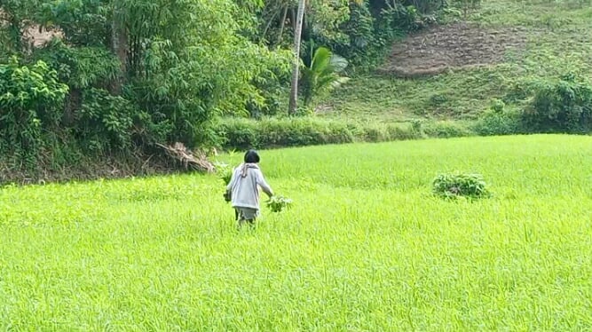
IN PHOTOS: A farmer who dedicates his entire time—days, months, and years—to planting rice in the fields, just to have something to serve on their table at the end of the day.
DONSOL, SORSOGON — Eight months after Typhoon Kristine hit the Bicol Region, the mud of trauma remains in effect at Barangay Banuang Gurang, Donsol, Sorsogon. The field is still in its grave, and the floodwaters remain visible in the eyes of farmers.
Last October 2024, the said barangay was among the hardest hit by the calamity — residents recall the harrowing experience of relentless rains and rising floodwaters, a memory that still lingers and haunts many of them to this day.
Just like how the floodwaters surged up, Myrna Meraballes, a longtime farmer who has spent decades tending to the land, didn’t give up. Instead, she still hoped that a better tomorrow would arise. She started farming when her children were still young and has lost count of how many times her farm field has been in its grave.
During the height of Typhoon Kristine, Meraballes and her family took shelter in a house on higher ground. The floodwaters swallowed the landscape, rising all the way to the treetops — an eerie sight that stayed for days before slowly letting go of the land.
“We weren’t able to evacuate because the road was already full of mud. We just stayed in a makeshift shelter during Typhoon Kristine,” she recalled.
Rice: Source of Life of the Residents
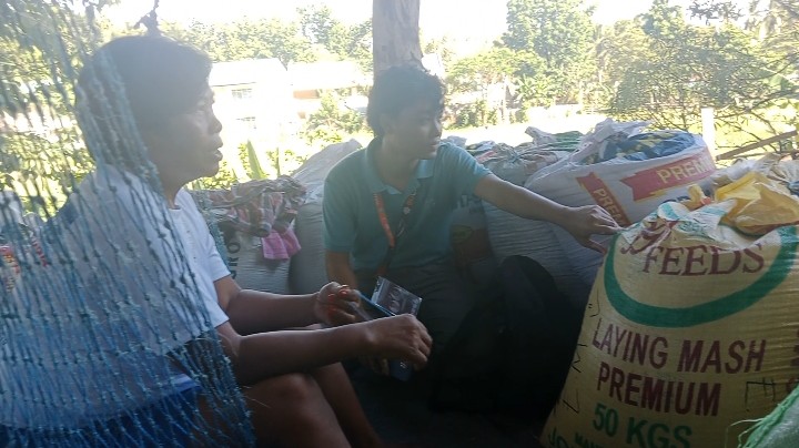
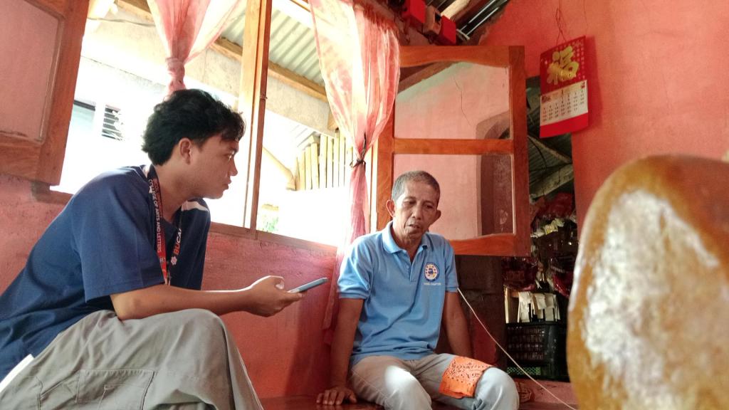
IN PHOTOS: A one-on-one interview with Myrna Meraballes, a long-time farmer and resident of Barangay Banuang Gurang.
In this town, farming is not a business — it is a way of life. The rice they harvest during the season is not meant for market stalls but reserved for their own tables — as daily sustenance and a source of security. But how’s their daily life if a disaster washed away their source of life?
Residents still held on to faith that there would be rice grains left to harvest after Typhoon Kristine devastated their farm field. Just like how the floodwaters began to recede, Meraballes finally eased — but all her rice crops had already been soaked and buried in the mud.
“It took a long time [for the flood to subside], almost three days. Our rice crops were all buried in mud; they were no longer usable, so we had to start over,” she said.
In an interview, Meraballes recalled how they poured their hopes into the soil — four sacks of rice, carefully divided from each hectare. Every sack wasn’t just grain — it was a gamble, a prayer and a sacrifice.
“We usually harvest 36 sacks, and even when it floods, we can still get some, but sometimes, there’s really nothing left at all,” she said.
Meanwhile, Eleanor Morada shared that due to the effects of Typhoon Kristine — such as heavy rains and flooding — her farm field was destroyed. Morada is a longtime farmer from Tongdol, a nearby barangay of Banuang Gurang.
“The flood had a huge impact on us because during Typhoon Kristine, all our rice fields and crops were completely damaged,” she shared.
She further shared that the aid from the Department of Agriculture (DA), such as rice seeds, greatly helped them to regrow.
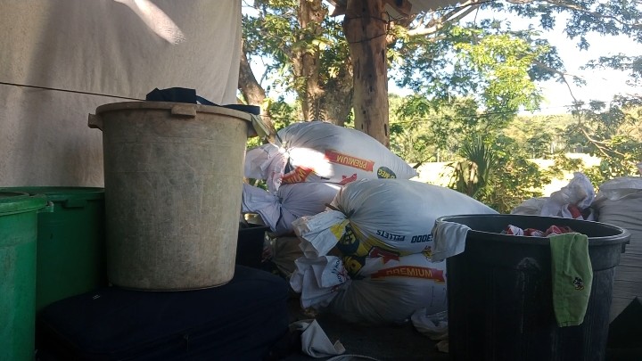
Buried in the Mud: The Losses of Farmers
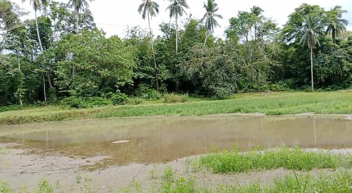
IN PHOTOS: The condition of rice fields before and after Typhoon Kristine struck the Region V- Bicol Region.
Before the typhoon, the rice fields of Banuang Gurang were alive with greenery — fresh crops buried in the mud.
According to the Barangay Fisheries and Agriculture Workers (BFAW), 32 farmers cultivated rice across 17 to 32 hectares of land. But when Typhoon Kristine arrived, nearly 80% of those crops were wiped out. In just a matter of hours, months of hard labor were drowned. What was once a thriving field became a wasteland of mud and silence.
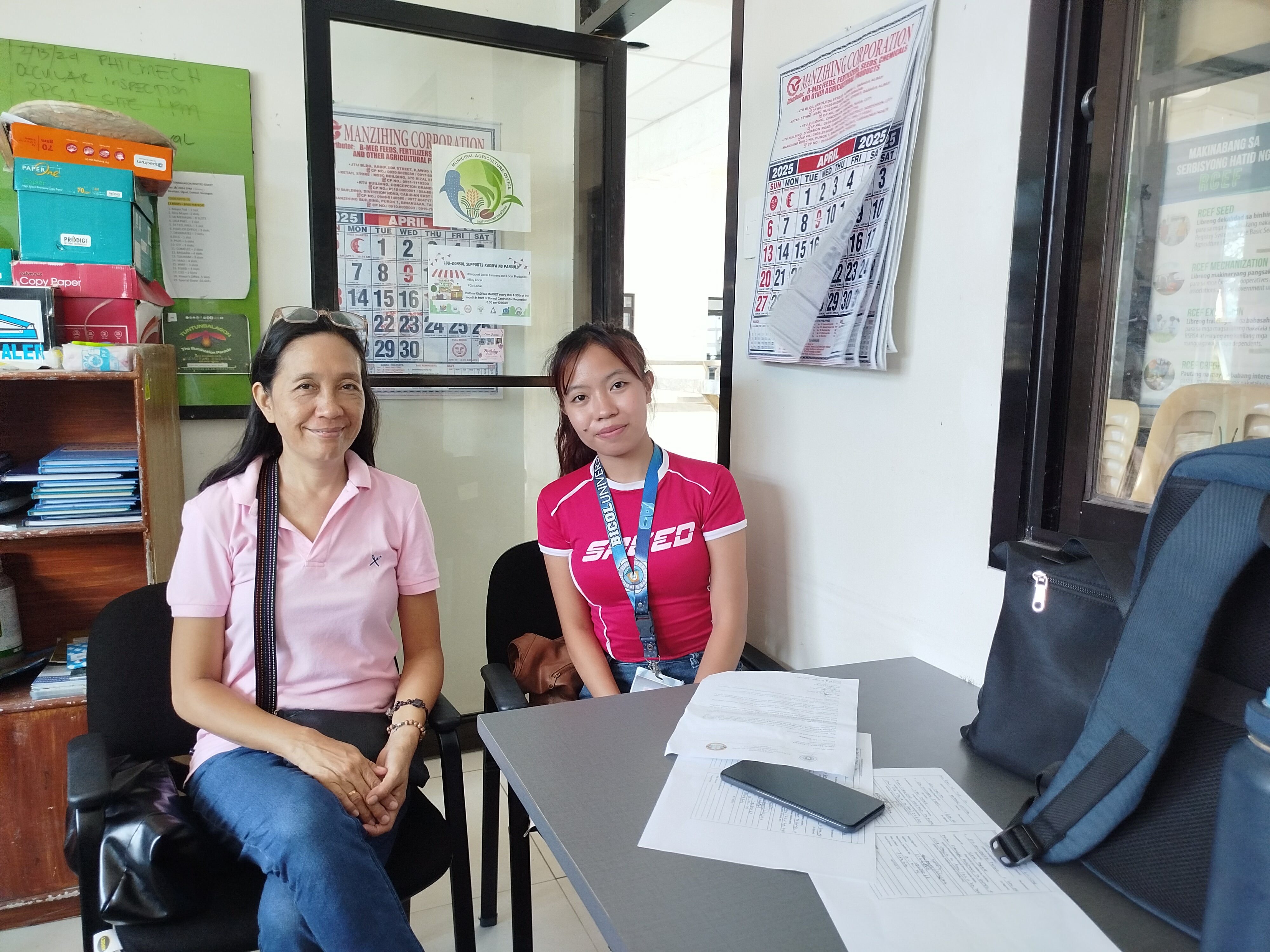
“Their rice crops were already in the flowering stage. So, the production loss for the farmers was around 36.7%. Instead of harvesting 49 metric tons, they lost 36.7 hectares because of the 80% damage,” Engineer Lindez Espada, head of the Municipal Agriculture Office in Donsol, said.
The rice fields, nestled in the low-lying parts of Banuang Gurang, were always at the mercy of rising waters. When the floods came, they stood no chance. The farmers, relying on traditional, non-hybrid rice varieties passed down through generations, had nothing to shield their crops. What they planted with care and memory was no match for the fury of the storm.
The rice that once was buried in the mud were the losses of the farmers — the crops were now just mud.
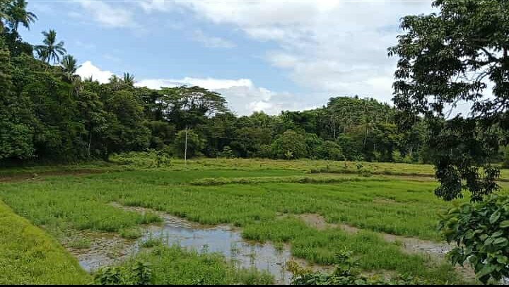
Flood Control: The Solution they Need
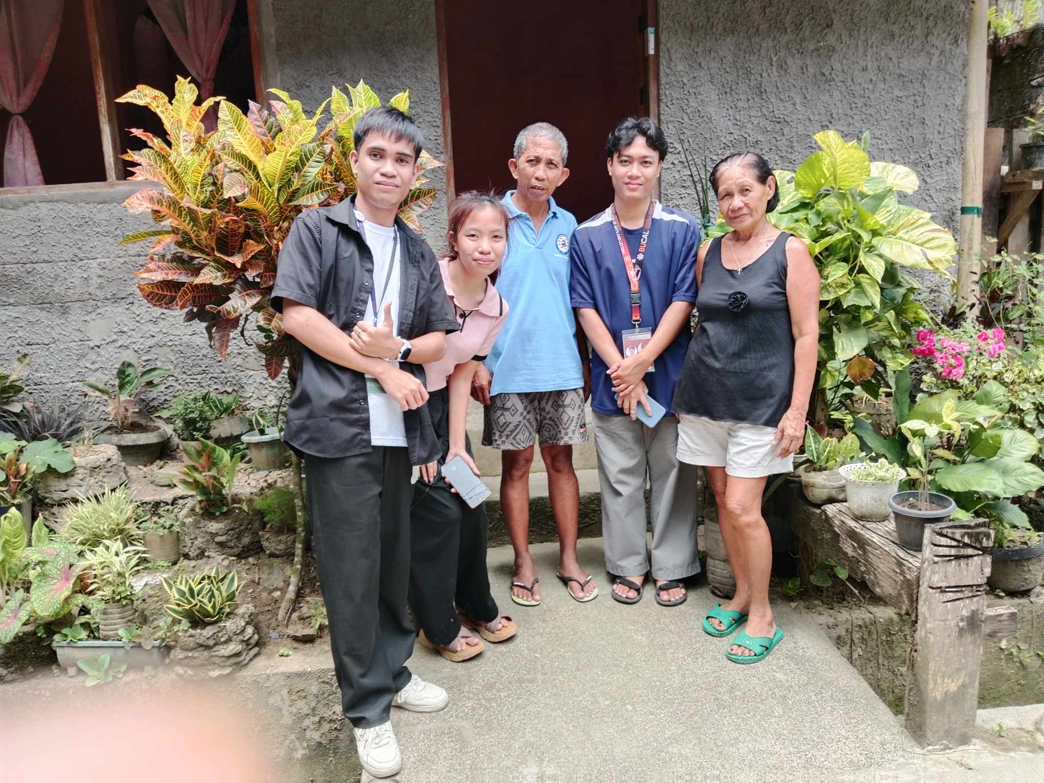
IN PHOTOS: Various locations and interviews with Angelo Llaguno, Barangay Captain of Banuang Gurang, Donsol, Sorsogon, and Eleanor Morada, a farmer, resident, and Barangay Health Worker (BHW) of Barangay Tongdol.
In every problem, there’s always a solution that awaits. In Donsol, Sorsogon, among its 51 barangays, this lowland community is one of the most flood-prone areas, according to Barangay Captain Angelo Llaguno.
For Franklin Dizon, a civil engineer who knows the land intimately, the story of flooding here is written in the geography itself. The area lies in a natural basin — low-lying land surrounded by hills and mountains. When the rains come, the water has nowhere to go but down, pouring into this vulnerable pocket like a relentless tide. To him, the heavy flooding isn’t just a random disaster — it’s a consequence of nature’s design, amplified by unforgiving terrain.
“This village is even more affected because it is the catch basin of water coming from Jovellar, Albay,” Dizon explained.
This natural role as a catch basin makes the locality particularly prone to heavy flooding. When rain falls in Jovellar and nearby areas, the water does not simply stay put — it travels, gathering speed and volume, and crashes down into the heart of this farming community.
To make matters worse, the settlement is adjacent to the province of Camarines Sur, which also contains basin areas prone to flooding. This geographical connection means that during heavy and prolonged rainfall, water runoff from both Albay and Camarines Sur converges toward the lowlands — placing this village directly in the path of multiple flood sources. In essence, it sits at the bottom of a natural funnel that collects stormwater from two directions, compounding the severity of the floods.
Residents have begun to notice that things are getting worse — not just because of climate change or stronger storms, but due to man-made changes as well. According to Meraballes, the construction of a spillway in the area may have exacerbated the problem.
“Apart from the fact that our village is surrounded by rivers, the construction of the spillway has contributed to the rise in floodwaters. During heavy rains, this place becomes even more vulnerable,” she said.
Captain Llaguno echoed concerns regarding the rehabilitation of the spillway. He described how residents were unaware of the full scope of the project at first.
“We thought it was just a bridge they were building until they brought in a bulldozer and excavated the area to place the spillway underneath. That made the flooding worse,” Llaguno said.
While the spillway was intended to help manage water flow, residents now question whether it is doing more harm than good. The recent storm overwhelmed its capacity, and instead of protecting homes, it may have helped submerge them.
Despite the growing toll of annual floods, the community has not given up. But it is clear that something needs to change — and fast. Lives, homes, and harvests are at stake. For Dizon, the answer lies not in temporary fixes, but in systemic and scientifically informed flood control solutions.
“The water that is supposed to be gathered in that area should be properly guided to an area lower than the residential zone for it to serve as the new catch basin,” he suggested.
#

Leave a comment